Dataset

FBIS-73M

Contains 1.48M satellite image patches with YOLO-format polygons for individual agricultural fields, for instance segmentation and boundary delineation.

Hugging Face ↗Sep 21, 2026Paper ↗

  • cv
  • satellite-imagery
  • field-boundary
  • instance-segmentation
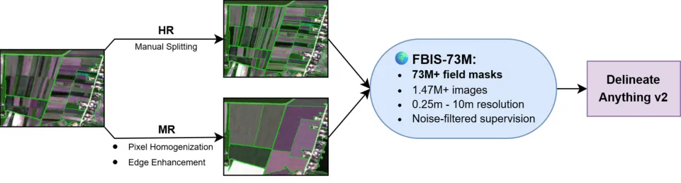
Pipeline diagram showing dataset construction from HR/MR to FBIS-73M and model

What it is

Large-scale satellite dataset for field boundary instance segmentation with 1.48M image patches and 74.0M field masks across train, test, and zero-shot splits. 1.48M multi-resolution satellite patches (0.25-10 m) with 74.0M per-field instance polygons, organized into train, test, and a 100-country zero-shot test split.

Key results

  • 1,478,096 image patches
  • 74,015,889 field instance masks
  • MIT license; 0.25-10 m imagery + 100-country zero-shot split

Useful for training and benchmarking field boundary delineation models, including zero-shot cross-country evaluation.

One useful ML email a week.

Worth your time, not all of your time.

We track new ML work across papers, code, and data, then keep only the pieces worth a closer look. Selected, not collected.

Papers.Data.Code

The Weekly ML Signal

Selected, not collected.

One useful ML email a week: the papers, repos and datasets worth your attention.

Worth your time, not all of your time.